
A mix of natural beauty and local history
A mix of natural beauty and local history

Take a walk through natural beauty with beautiful views of the Maribyrnong River, natural flora and native wildlife. Includes significant historical sites along the way.


Summary
Take a walk through natural beauty with beautiful views of the Maribyrnong River, natural flora and native wildlife. Includes significant historical sites along the way.
Description
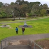
This walk starts at the Canning Street Reserve. A popular spot for picnics with bbq facilities, toilets and a playground. It also has a fishing platform. Only 14km from the CBD, sections of this walk feel like you are in the middle of the bush. Beautiful natural areas coincide with significant historical sites.
To get here
Car - There is free parking at the reserve
Public Transport – both the 406 and 407 bus pass by the Reserve
Keep dog on a leash at Canning Reserve, however dogs can be off the leash at different parts of this walk.
In terms of safety – it’s best to do this section with someone as it can seem a little isolating.
Watch for planes overhead as you can get a close view.
Flora – look out for beautiful red river gums and silver wattle
Fauna - Listen and watch out for willy wagtails, magpies, ducks and comorants.
Sections of the walk are gravel or dirt making it difficult for wheelchair access. It can get muddy after heavy rainfalls.
Once you get to the end of this walk, if you don’t wish to walk back along the track, you can make a take a shortcut - go up the dirt track from Solomon’s Ford that leads to Canning Street. Walk along Canning Street to Canning Reserve (about 25 minute walk) or alternatively you can take bus 406 corner of Riverside Avenue and Military Roads.
814 Views
Points of Interest

1. Canning Reserve
Was the home of the Riverview Tea Gardens – established in 1909 it was the centre of recreational activities in the local area until 1947. Look for remnants of the tea gardens on the riverbank.

2. Fish Sculpture - Commonwealth Games
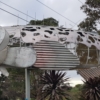
As you enter the Reserve, notice the big fish. This was one of the 72 fish sculptures used in the 2006 Melbourne Commonwealth Games to depict each nation. Canning Reserve holds the Seychelles Blenny.
3. Canning Street Bridge
Built in 1921 to replace a narrow military bridge. Remnants of the old bridge can still be seen.

4. Old Stair Path
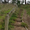
Continue walking passing the Medway golf course on the left. Look for some interesting stairs on your right. There are some nice views of the river from here.

5. Maribyrnong River Pipe Bridge - Ahern St
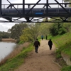
Built circa 1929, this bridge is of significant heritage as it was one of the first major links to supply water to Melbourne’s West.

6. Crossroads - signs
Go towards Brimbank Park. This area is 'Grimes Flat'. Named after Charles Grimes, the first non-Aboriginal to survey the River in 1803. He said this area was ‘beautiful beyond description'.

7. Quang Minh Temple
Look up at to the hill on the left and you will see glimpses of the Quang Minh Temple. The Temple is a centre for the Vietnamese Buddhist community in Victoria. Construction began in 1980s.

8. Solomon's Ford
This ford was an important site for Aboriginal people. It served as a fish trap system, a crossing point and camping site with a scarred tree and quarry site found in this area.
Features
 Public Transport
 Playground
 Picnic spot
 Dog off-leash area
 Public toilets
 Historical interest
 Nature trail
 Lake, creek, river
 Park / Garden


